-
Global
-
Africa
-
Asia Pacific
-
Europe
-
Latin America
-
Middle East
-
North America
- |
- BUSINESSES
- |
- Contact
- |
-
Global
-
Africa
-
Asia Pacific
-
Europe
-
Latin America
-
Middle East
-
North America
- |
- BUSINESSES
- |
- Contact
- |
You are browsing the product catalog for
You are viewing the overview and resources for
- News
- Tracking Recent Extreme Weather With the SWOT Satellite
Tracking Recent Extreme Weather With the SWOT Satellite
Space exploration isn’t only about studying what’s out there in our universe – it can help us better understand our planet and climate change.
In June, NASA and partner researchers found themselves in boats on Alaska’s Yukon River. As they used GPS to track the slope of the river, sensors aboard a plane flying overhead served as a second source of data collection. This approach to measuring the Yukon River was a test run. The combined findings were being used as confirmation for the findings of the Surface Water Ocean Topography (SWOT) satellite.
The SWOT mission launched in December 2022 with a goal to obtain the most comprehensive view and measurements of the world’s surface water. Conducted in partnership between NASA and the Canadian, UK, and French space agencies, its findings are critical in times of unprecedented weather events and rising seas levels that result from ongoing climate change.
SWOT is able to take measurements that are 10 times more accurate than any previous Earth observation satellite.
Such precision will allow SWOT to “help researchers better understand how climate change affects water storage in lakes, rivers, and reservoirs, and how communities can better manage water resources and prepare for floods and other disasters,” according to NASA.
SWOT’s first findings included a thorough mapping of the waterways on Long Island and exact height measurements of the Gulf Stream off North Carolina and Virginia.
The nature of weather events since the first SWOT data sets became available in March demonstrates the need for clear data on the global impact of climate change. SWOT’s detection abilities go beyond simply tracking rising sea levels. It will provide, as explained by NASA, an unprecedented tracking of small ocean features related to heat and carbon capture in the oceans that can lead to more accurate prediction of weather events and patterns.
More refined draught and rising sea level assessments can be applied to emergency planning as well as remediation strategies. Clearer insights can also inform disaster readiness through more robust predictive models, as well as financial concerns such as flood insurance.
Quantifying the impact of climate change
Recent events around the world highlight the impacts of climate change on the environment.
A few examples:
From July 10 to 11, “rainfall amounts of 3 to 9 inches were observed across the state [of Vermont] over 48 hours,” according to The National Weather Service. In addition to roads and bridges being inundated or washed away, thousands lost their homes or businesses. Two people died from the flooding in Vermont, per The New York Times.
Extraordinarily high rainfall in a short time span in Libya has claimed thousands of lives while displacing many more. And scientists with World Weather Attribution have found that climate change made such heavy rainfall in a short time span 50 times more likely, according to Reuters.
NASA reported that “July 2023 was hotter than any other month in the global temperature record.”
Prolonged wildfires in Canada impacted air quality for an entire continent, as well as sudden, deadly wildfires that devastated the Hawaiian islands of Maui and the Big Island.
Across five days, Greece faced 350 fires—joining a long list of countries facing a sobering reality: that “Greenhouse gas emissions have greatly increased the chances of hot, dry weather that makes severe fires more likely,” according to the Associated Press.
In early September, Hong Kong, Greece, and Turkey saw catastrophic rainfall and flooding as “extreme weather events hit ten countries and territories in twelve days,” according to CNN.
In late September, heavy rains led to flash flooding in the New York City metro area. The National Weather Service reported that on Friday, September 29, more rain fell in a single day at New York’s John F. Kennedy International Airport than any day since 1948.
In light of extreme weather events, detailed predictive models and visuals are becoming more important to help people prepare and acclimate.
That is where the SWOT satellite can help. The satellite includes technology from Honeywell space systems that can measure water surface height within 2 centimeters. This accuracy is possible through an instrument known as the KA-Band Radar Interferometer, which uses radar pulses sent from roughly 530 miles above the Earth’s surface. Because sea rise affects regions differently, SWOT can provide measurements on a case-by-case basis that can lead to more detailed findings.
More recently, SWOT has visualized higher than normal ocean water heights off the California coast that scientists attribute to warming ocean currents, as reported by NASA.
Thanks to this low-Earth orbit satellite, researchers now have more detailed ways to visualize oceans, lakes and smaller waterways on Earth, affording us a greater opportunity to be more proactive in addressing the effects of climate change.
Looking for more stories about space? Read about the innovations in development that will help take humans to Mars.
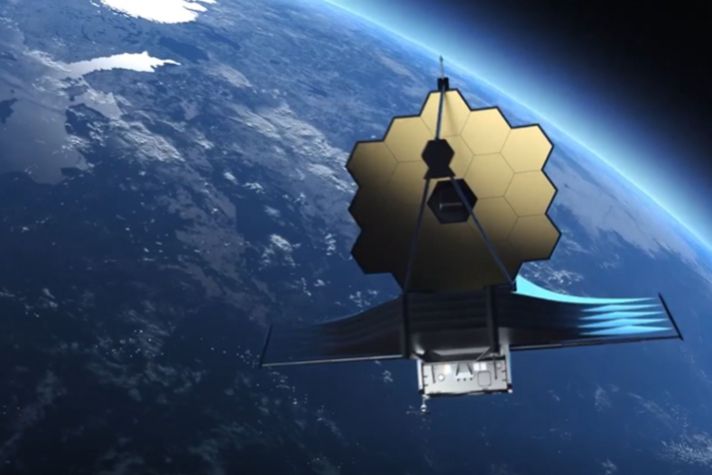
Cover image sources: NASA/JPL-Caltech, Space X


Copyright © 2025 Honeywell International Inc.
